 Is the professional’s choice for Public Safety, Construction, Inspection, Real Estate, Surveying, Infrastructure, Mapping, Corridor Planning, Volumetrics, Facade Scanning, Agriculture, Disaster Assessment, and many other applications that require 2d (ortho) or 3D modelling output.
Pix4D is one of our focus applications, offered in four core learning opportunities. Use case-dependent classes are optimized for general use/relative accuracy to training for RTK-supported, absolute accuracy are available, with median offerings for standard uses available.
Relative accuracy allows forensics, UAS Pilots, accident scene reconstructionists, construction site supervisors/managers/stakeholders to see a project in relevance to itself, with measureable accuracy in the captured and stitched/assembled images (both 3D and 2D, yet the images will not be relative to their location on the ground, with errors ranging from as great as three meters (Bare) to as small as 3-5cm (Better). Absolute accuracy presents an image that is absolutely correlated with location in geospace, and offers accuracy of 1cm (Best) when proper equipment and techniques are applied . We offer programs that address every budget regardless of application.
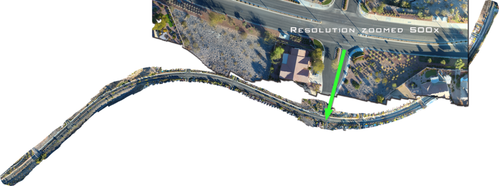
This image illustrates the quality of a 2D or 3D image, of more than 2 miles of roadway, being measured for construction of a bicycle pathway.
Our Pix4D training is WORKFLOW-FOCUSED. We focus on specific vertical uses (Public Safety, Forensics, Crash Reconstruction, Construction, and land/site development), including third party tools, output, and real-world use-case functionality.
BARE
Pix4D allows users that do not possess specialized GIS-grade equipment to rapidly create relatively accurate models. This method of capture is very fast, and is common for casual users that do not need to illustrate scenes or objects in absolute space. However, “BARE” methods allow for reasonably accurate outputs.
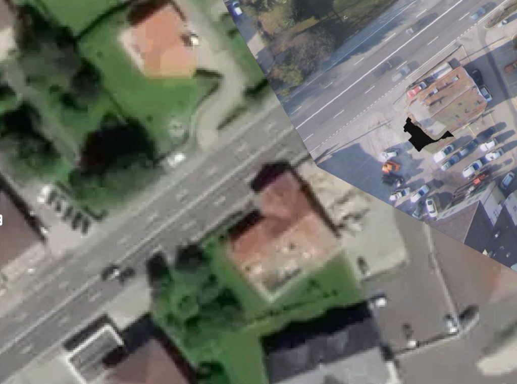
To create relative models, users merely need an UAS, a computer, and Pix4D. Measurements in the scene will be relatively accurate. The below scene is comprised of 154 images. Notice in the accident scene, the stitched image is nearly 20 feet out of absolute accuracy, for a very wide margin of error. This is practical for the vast majority of Pix4D user applications.
This is a one-day course, and may easily be expanded to a two day course to include more accurate methods of capture and post-capture processing.
We also offer this single day of Pix4D training with a UAS course for practical flight planning, camera settings, risk mitigation, and optimal practices to ensure proper capture of images for creating ortho or 3D maps/images.
Don’t have Pix4D? We’re happy to recommend one of our favorite resellers in your region/area.
One Day Class- $595 per person; group discounts are available.
Schedule a class NOW!
BETTER
Using Manual Tie Points/MTP, users can gain greater accuracy on the ground using known, immovable points on the ground to increase accuracy and improve overall image completion. Any user can create their own tie points, or identify points on the ground that are fixed in place, such as the base of a street lamp, a bolt on a manhole cover, the corner of a statue, etc.
This is a one-day course typically combined with other training. We highly recommend this course as a two-day program that incorporates training for optimal camera settings, flight planning, MTP identification, placement, safety considerations, and application-specific best practices.
Our second most popular class, this is a two-day training, where we’ll put aircraft up and capture images/data from a local scene, stitched together in the classroom to best demonstrate best practices and procedures for optimal Pix4D output and delivery. Attendees bring their own computers, and we’ll provide the Pix4D licenses for the duration of the training.
Note the relative accuracy in the below image.
Two Day Class $995 per person; group discounts are available.
Schedule a class NOW!
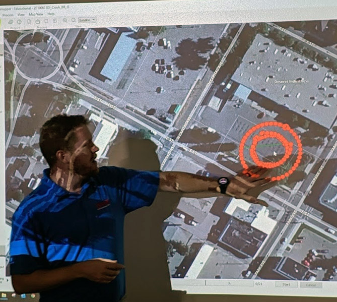
BEST
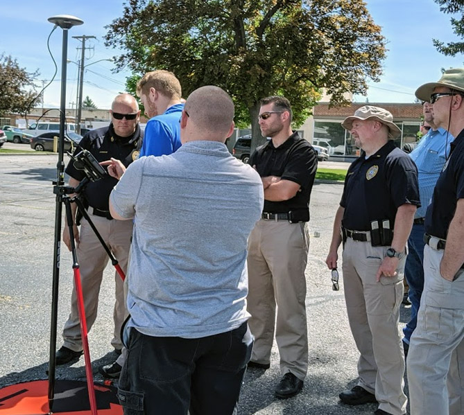
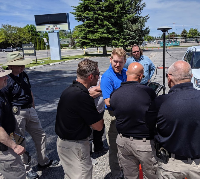
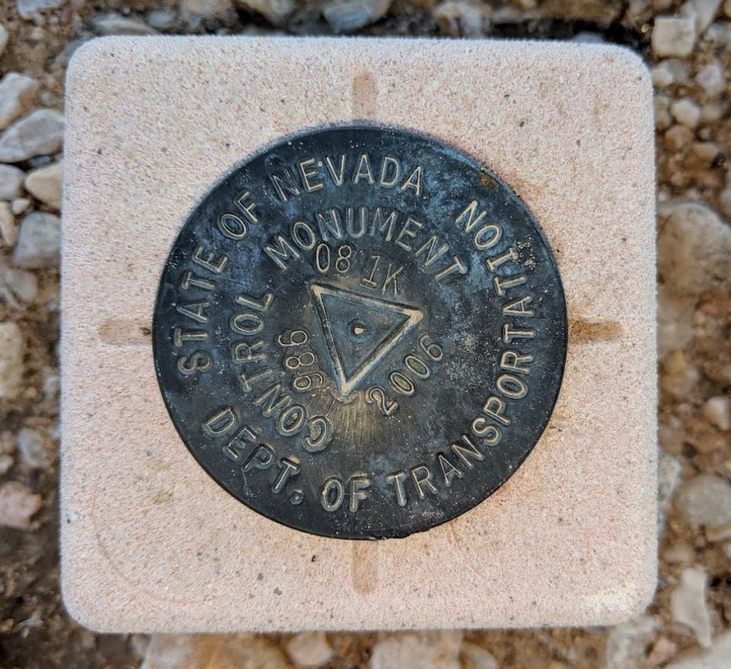 Using Ground Control Points is the optimal method in capturing absolute accuracy on the ground. Utilizing known locations on the earth coupled with geodata from the drone, users may create 1cm accurate maps of the earth. Optimal applications of this technique and technology are forensics, critical accident scene reconstruction, construction, and other similar applications requiring absolute accuracy. DT Research, Trimble, Leica GIS systems and ground control points (GCP) synchronize to provide critical accuracy.
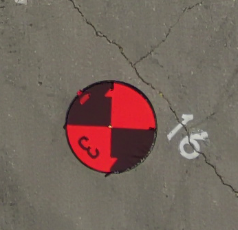 This method combined with RTK technology enables absolute accuracy as required for Construction/AEC, Forensics (Accident Scenes, Crime Scenes), Infrastructure, Mapping, and other applications requiring absolute positioning.
Our most popular class, this is a two-day or three-day training, where we’ll put aircraft up and capture images/data from a local scene stitched together in the classroom to best demonstrate best practices and procedures for optimal Pix4D output and delivery. We also demonstrate various outputs for multiple uses and sharing of projects with annotation, measurements, etc without exporting data to the cloud. Attendees bring their own computers, and we’ll provide the Pix4D licenses for the duration of the training.
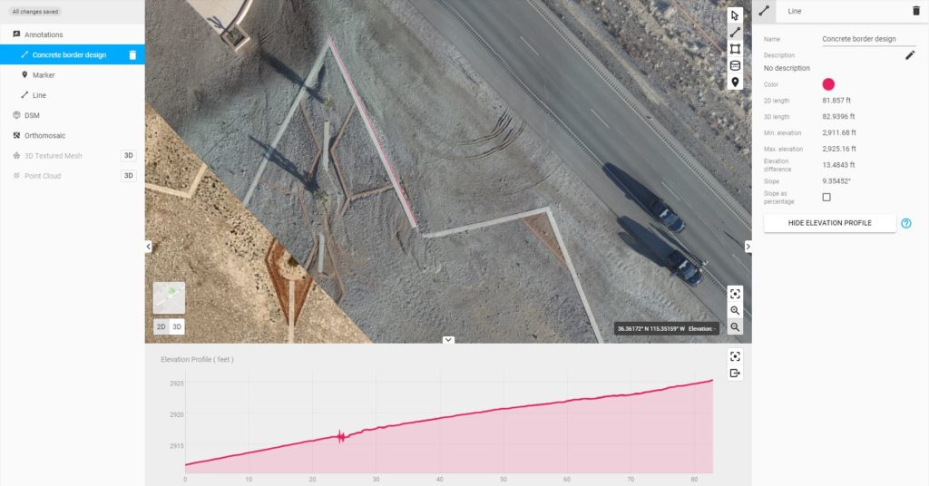
In the image below, a city street is measured for pre-construction planning for a new bike lane.
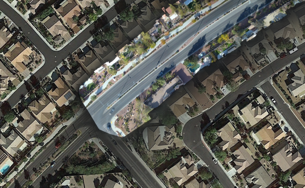
Three-Day Class $1495 per person; group discounts are available.
Schedule a class NOW!
Planning and preparing for the datacapture flight is the most critical component of a successful capture of images to be loaded into Pix4D. Whether working towards relative or absolute accuracy, a proper setup is the first (and most important) step of any capture. Time of day, camera settings, winds aloft, flight direction/planning all play a role, and our training program removes all the questions, trial, and error in learning this process.
Our classes are application specific, so each class/session may be different for each vertical. For example, projects destined for a courtroom are different than projects for AEC output. Knowing how to set up the environment and markers is critical to ensuring proper scene capture for post-event analysis.
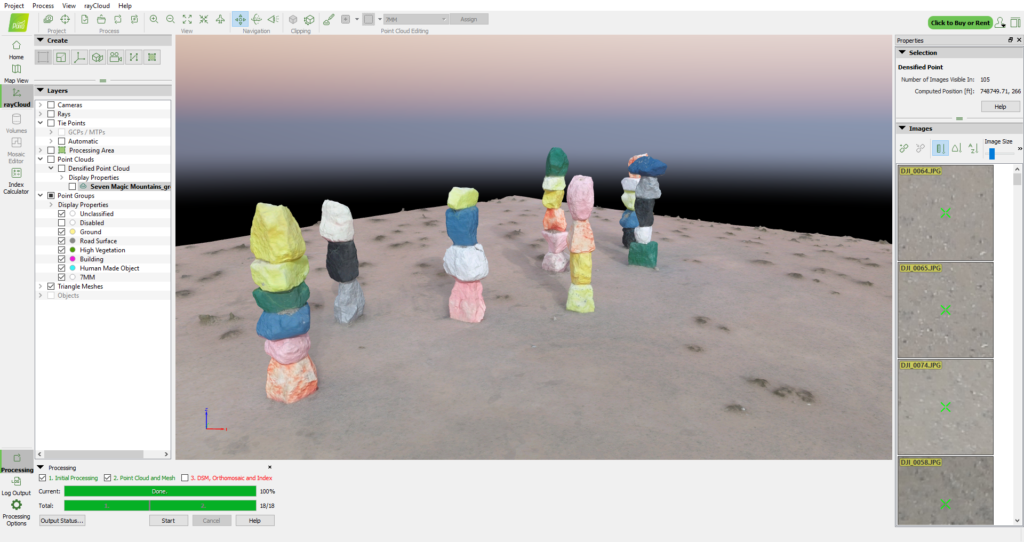
The model below is a representation of the 7 Magic Mountain Art Exhibit near Jean, Nevada. Zoom in/out using the mouse wheel, or use the mouse to tilt or rotate the model output from Pix4D
What you will learn:
- Large area image acquisition
- Understand absolute vs relative accuracy
- Describe findings in a Quality Report
- Programming a mission for optimal flight and image acquisition
- Programming a mission for multiple battery change-outs
- Aeronautical Decision-Making for best flight potential
Two-Day Course:
In addition to above;
- Flight techniques (field) for optimal image input
- Camera settings (field) for optimal image quality
- Capturing images from multiple aircraft
- Placement of checkpoints and MTP/GCP on the ground
- Merging images from sub projects using MTP
- Orthoplane and surface processing
- Processing area
- Data Management/wrangling of images/packaging of projects for archive/delivery
Three-Day Course:
In addition to the above;
- Use of/importing GCP information from GIS system
- Placement of GCP in challenging environments
- Capturing data in uneven terrain
- In-Depth examination of Quality Reports output from each stage of the process
- Trouble-shooting problems in Pix4D
- Accuracy validation in third-party tools
- Batch processing photos for import into Pix4D
- Extracting video frames for modelling in Pix4D
- Output to 3D, video, and other formats for distribution, analysis, and data sharing
